POCATELLO, Idaho — The National Weather Service’s Pocatello, Idaho, office (NWS) issued a Hydrologic Outlook for eastern Idaho including Teton Valley, warning residents that the recent warmer temperatures could lead to flooding.
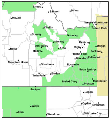
“Temperatures will continue to run well above average through Thursday, increasing low and mid elevation snowmelt and runoff,” the outlook reads. “Standing water in typical low spots can be expected, and we’ll also likely begin seeing the swelling of smaller creeks and tributaries that feed the larger streams and rivers. This may even push some streams and creeks above bankfull causing minor flooding and bank erosion due to the higher flows.”
NWS forecasts temperatures staying “anomalously warm” on Thursday until colder temperatures descend on Thursday night. Overnight lows are expected to return to freezing by Saturday morning.
“Stay away from fast moving water, swollen river banks and never attempt to cross flowing water over roadway,” the outlook reads.