


Sunday’s storm took a while to get going, but then it snowed heavily Sunday afternoon and evening with storm total snow amounts ranging from 10-16″ across the Tetons. Warmer temperatures in the valley resulted in only minor accumulations for the town of Jackson. After a relative break in the action early this week, more snow will arrive toward the end of this week.
A break in the pattern on Monday, isolated flurries on Tuesday and Wednesday
Skies have become mostly sunny in the wake of Sunday’s storm. It should be a nice day out on the slopes with fresh snow and clear skies. Jackson Hole Mountain Resort is reporting 8-14″ of new snow across the mid to upper mountain over the past 24 hours!
It will be a mostly quiet first half of the week, but there are going to be two minor disturbances arriving. The first will arrive Monday night and into Tuesday morning, with increasing clouds and light snow showers and flurries possible at times. This will not be a big deal, with any snowfall resulting in an inch or less in the mountains, and a dusting in the valley.
The second weak disturbance will arrive during the day Wednesday, with similar impacts – occasional snow flurries or light snow showers, but minimal if any accumulations.
From Monday through Wednesday, we will generally see highs in the upper 20s to low 30s in the valley, with overnight lows in the single digits to teens depending on the extent of cloud cover (more clouds = warmer overnight lows).
Next storm will bring snow on Thursday and Friday (and possibly Saturday too)
The next storm system will approach from the northwest late this week, bringing a good round of snow to the Tetons starting on Thursday, and persisting into Friday.
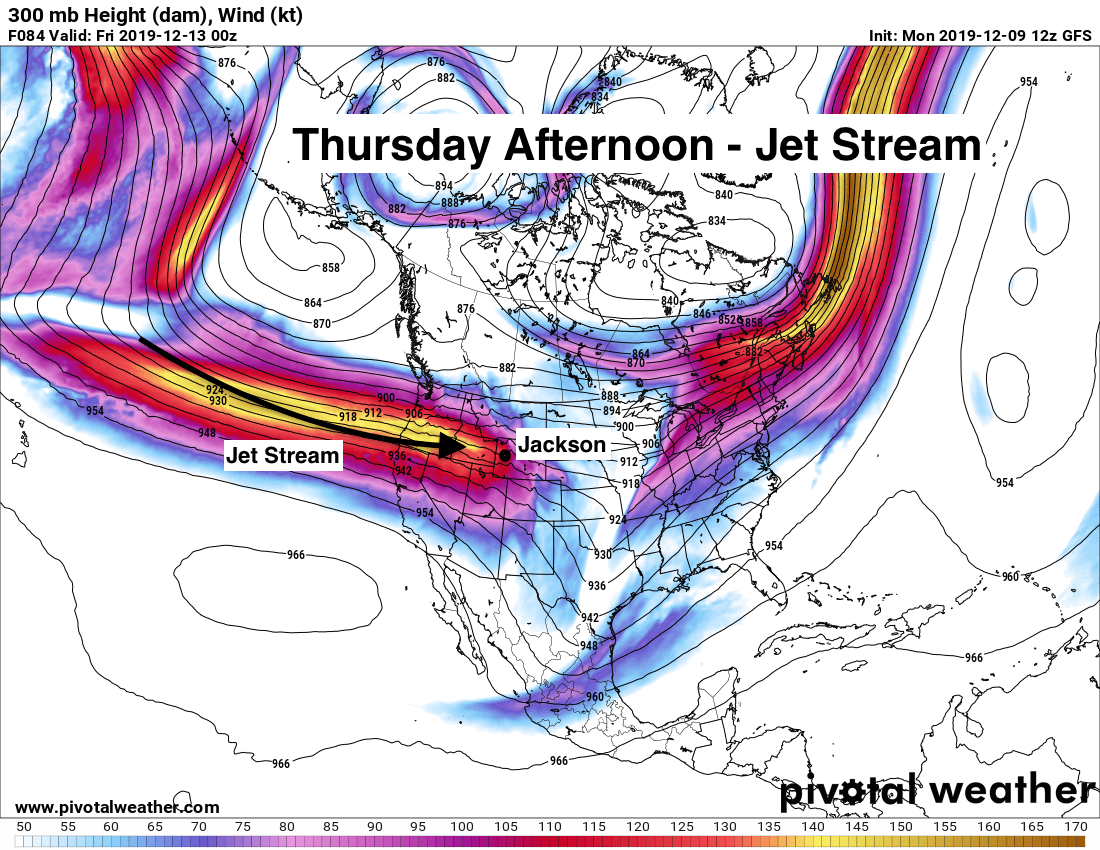
A second storm system will bring a chance of snow to the area on Saturday as well, though question marks remain whether or not this second storm tracks too far south of Jackson to produce significant snow.
For skiers, look for improving snow conditions from Thursday on as the snow starts to pile up. For travel, Teton and Togwotee Passes will start to see deteriorating conditions Thursday night and Friday morning, and conditions could remain challenging through the weekend depending on how heavy the new snowfall is each day.
Looking at the long-range outlook, we should stay in a fairly active pattern heading into next week as well. Good news for the ski areas!
Alan Smith, Meteorologist, JacksonHoleSnowForecast.com










