JACKSON, Wyo. — Ready for more pow?
The National Weather Service’s Riverton, Wyoming, office (NWS) has issued a Winter Storm Watch affecting Jackson Hole, the Teton and Gros Ventre mountain ranges, Yellowstone National Park, Star Valley and more, forecasting potential heavy snow between Friday afternoon and Sunday afternoon.
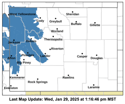
“Heavy snow possible,” the alert reads. “Total snow accumulations between 8 and 16 inches possible for lower elevations, and 24 to 48 inches for higher elevations and most of Yellowstone National Park.”
NWS also noted that the storm could extend into early next week. Caution is advised for those who must drive in these conditions.
“Travel could be very difficult,” the alert reads. “Roads will quickly become slick and hazardous. Gusty winds will create blowing and drifting conditions.”
Stay tuned for more in-depth weather analysis Wednesday afternoon by Buckrail Meteorologist Alan Smith.