


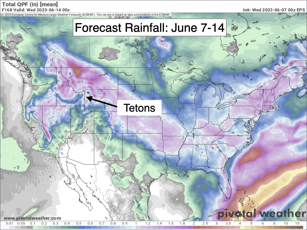
JACKSON, Wyo. – A persistent cycle of daily afternoon showers/thunderstorms will continue for at least another week as the large-scale weather pattern across North America exhibits little change.
In fact, Wednesday will likely feature stronger and more widespread thunderstorms across Teton County and Western Wyoming. The culprit will be a large area of low pressure near the California/Nevada border that is slowly moving northward.
South/southeast winds around the center of low pressure will transport an abundance of subtropical moisture into Jackson Hole and Western Wyoming.
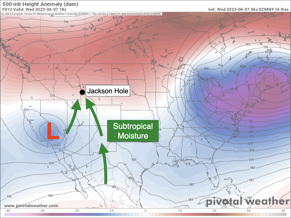
As the sun heats up and destabilizes the atmosphere on Wednesday, thunderstorms could develop as early as midday with multiple rounds of thunderstorms and showers possible through the afternoon and early evening hours.
Instability will be quite high on Wednesday afternoon, supporting strong updrafts and the potential for strong thunderstorms capable of producing frequent cloud-to-ground lightning, medium-size hail and locally heavy rain. Storms will also be relatively slow-moving from south/southeast to north/northwest.
Scattered showers will remain possible during the overnight hours on Wednesday night, and an overnight thunderstorm couldn’t be ruled out either.
On Thursday, atmospheric moisture levels will be significant. However, widespread overcast cloud cover is expected through at least the morning hours and could persist throughout the day.
Scattered showers will be possible at all hours of the day on Thursday, but heavy cloud cover and a lack of solar heating could suppress thunderstorm development. If the sun manages to come out at all on Thursday afternoon, then strong thunderstorms would be possible with the potential for heavy rain. But this would probably be a later-day threat, if at all.
On Friday and Saturday, more sunshine is expected compared to Thursday, which should result in nice weather windows during the morning hours. However, lingering moisture combined with daytime instability will result in scattered afternoon thunderstorms both days.
Additional low pressure systems are then expected to move into the Western U.S. early next week, which may result in an uptick in thunderstorm activity on Sunday and Monday depending on the track of the low and resulting moisture transport and wind directions.
Daily chances of showers and thunderstorms are expected to persist through at least the middle of next week as well – both locally and across a large portion of the Western U.S.
As far as temperatures go, highs will reach the low to mid 70s on Wednesday with cooler highs in the low to mid 60s on Thursday. From Friday through early next week, highs will generally range from the upper 60s to low 70s. Overnight lows will range from the upper 30s to upper 40s depending on cloud cover.
Alan Smith, Meteorologist









