


JACKSON, Wyo. – A cooler and wetter pattern will take hold from Thursday to Saturday, with showers and thunderstorms, below average temperatures, and a reduction in wildfire smoke expected. A relatively active pattern should continue next week as well as moisture from the Southwest Monsoon sticks around.
Recent Weather Pattern
Hot, dry, and smoky conditions prevailed over the past week with a ridge of high pressure centered just to our south, while a westerly flow aloft transported smoke from Pacific Northwest wildfires into our area.
Following a brief cool-down early last week, high temperatures topped out close to 90ºF (daily values ranged from 88-91ºF) on six consecutive days, ending Tuesday.
Most areas did not see any rain over the past week, though an isolated brief shower in the town of Jackson produced a quick 0.02 inches on Monday.
Here is the 7-day weather summary for the town of Jackson:

For perspective, the average high and low temperatures in Jackson on August 12 are 81º and 43º.
Upcoming Weather Pattern
A pattern change is underway on Wednesday, as we have already seen cooler temperatures, increased cloud cover, and a reduction in wildfire smoke, thanks to a trough of low pressure setting up along the West Coast which is leading to a wind shift in the upper atmosphere.
Winds aloft are shifting from westerly to southwesterly, which will help to push most of the wildfire smoke from Washington and Oregon north of our area.
The high pressure ridge that was located over the Southwest last week has migrated eastward into the Central and Southeast U.S. Meanwhile, a trough of low pressure has set up along the West Coast.
In between the trough and the ridge, south/southwest winds are pulling moisture from the Southwest Monsoon northward into our area, and we are already seeing increased humidity levels and cloud cover on Wednesday, with some thunderstorm activity bubbling up over Eastern Idaho as of late afternoon.
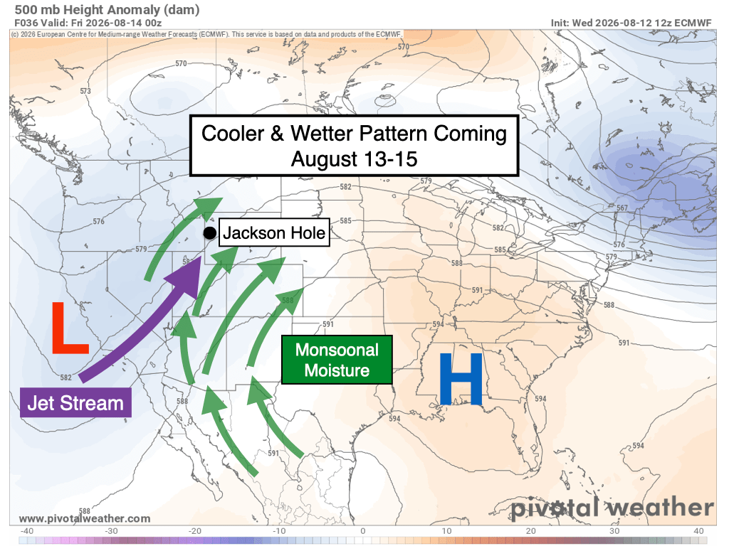
From Thursday to Saturday, a series of shortwave disturbances, or pulses of “energy” in the upper atmosphere, will interact with the increasing moisture to result in a good chance of showers and thunderstorms each day.
The afternoon and evening hours will likely feature the peak of shower/thunderstorm activity, but there is at least a chance of rain and lightning during the morning hours each day during this stretch as well, so heads up if you have climbing or outdoor plans.
Rainfall tends to be hit or miss at this time of year, but most locations in Teton County and Western Wyoming should pick up meaningful rains in this pattern, and some areas will see locally heavy rain.
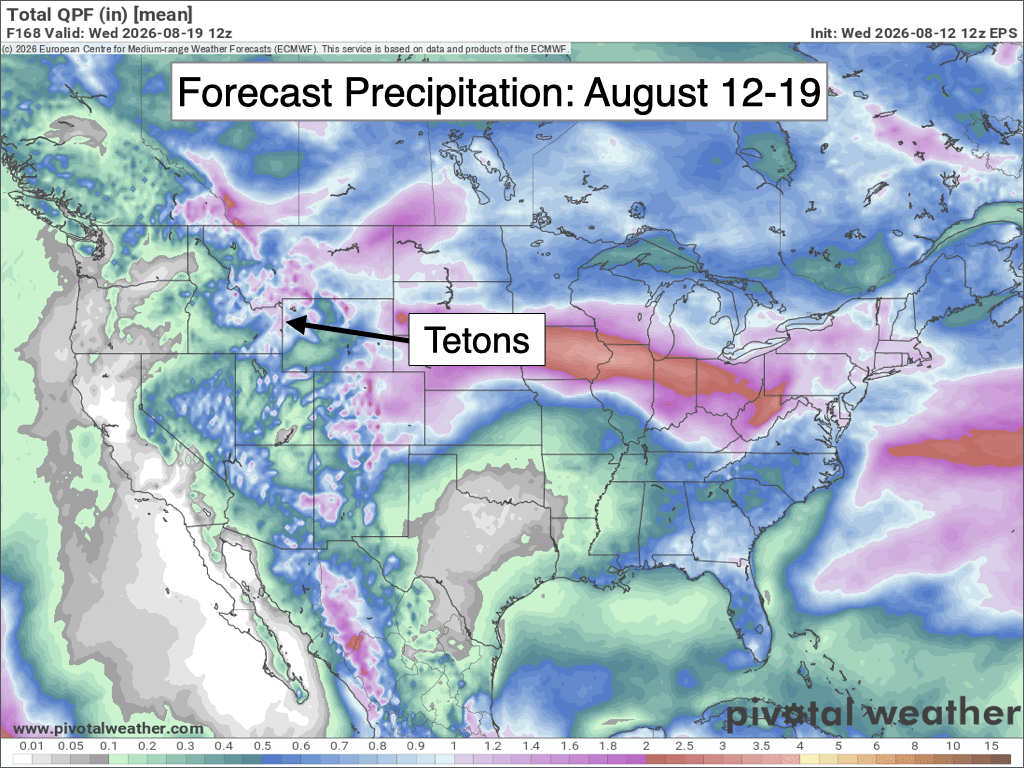
Most weather models are projecting around 0.5 to 0.75 inches of rain in the valley through Saturday, and 0.75 to 1.5 inches in the Tetons, but there will likely be some variability outside of these ranges as well given the hit or miss nature of convective rainfall.
Unlike the monsoonal flow pattern we experienced during this second half of July, this pattern will feature noticeably cooler air from Thursday to Saturday with highs only in the low to mid 70s in the valley each day. This is about 5-10 degrees below average for mid-August.
Starting on Sunday, the pattern should relax somewhat with increased sunshine and a more typical afternoon thunderstorm threat.
We may see a similar pattern for most of next week as a monsoonal flow remains in place with above-average moisture levels, leading to frequent chances for afternoon thunderstorms. Some days will be more active than others with these details coming into better focus as we get closer.
Here is the 7-day rainfall projection from the European Ensemble Model, which represents the average of 50 simulations of this model. A clear wet signal across the Interior West and Rockies as a whole.
Looking beyond August 19th, NOAA’s 8-14 day outlook continues to favor above-average rainfall through August 26th, though a return to above-average temperatures is also expected – a reminder that summer is not over yet, despite the cooler temperatures we will see late this week.

Alan Smith, Meteorologist









