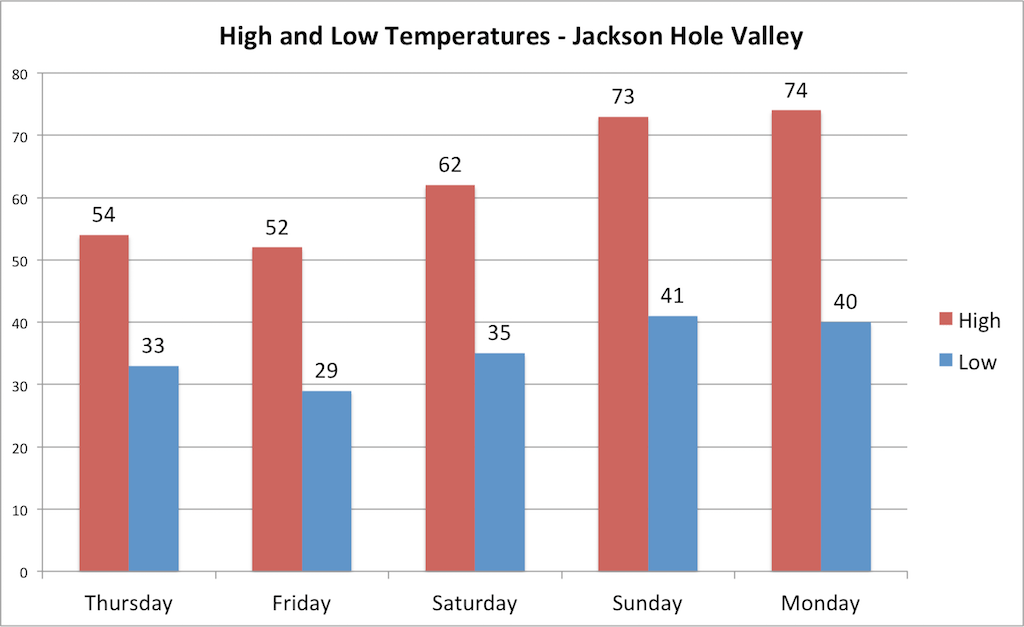
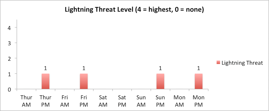
A cool and unsettled weather pattern will continue on Thursday and Friday before drying out and warming up over the weekend. Skies will be mostly cloudy on Thursday, but conditions should largely stay dry through mid-afternoon (3pm or so). A disturbance will arrive from the west late in the afternoon with rain showers developing and continuing through Thursday night.
The rain/snow line will range from 7,500-8,500 ft. on Thursday afternoon before falling to 6,000-7,000 ft. on Thursday night and Friday morning, so it’s possible we could see some snowflakes falling in the valley on Friday morning. Higher elevations above 8,500 ft. will see new snow amounts of 1-3 inches through Friday morning.
Friday will be another cool and mostly cloudy day with scattered showers early, though we should see some breaks later in the morning and around midday. Additional showers will then develop on Friday afternoon and evening as a final disturbance arrives, though this disturbance is looking weaker and not quite as wet compared to previous forecasts.
Another inch or two of snow will be possible up high on Friday afternoon/evening with snow levels ranging from 7,000-8,000 ft. This final wave should exit by roughly midnight on Friday night.
Conditions will dry out over the weekend and temperatures will warm up significantly as high pressure strengthens over Wyoming. Saturday will be dry and mostly sunny with highs in the low 60s, then we will warm up into the 70s on Sunday and Monday with gusty southerly winds also developing. We may see just enough moisture and instability sneak in for a minor threat of an afternoon thunderstorm on Sunday and Monday, but otherwise, conditions are looking rather dry.
Alan Smith, Meteorologist