


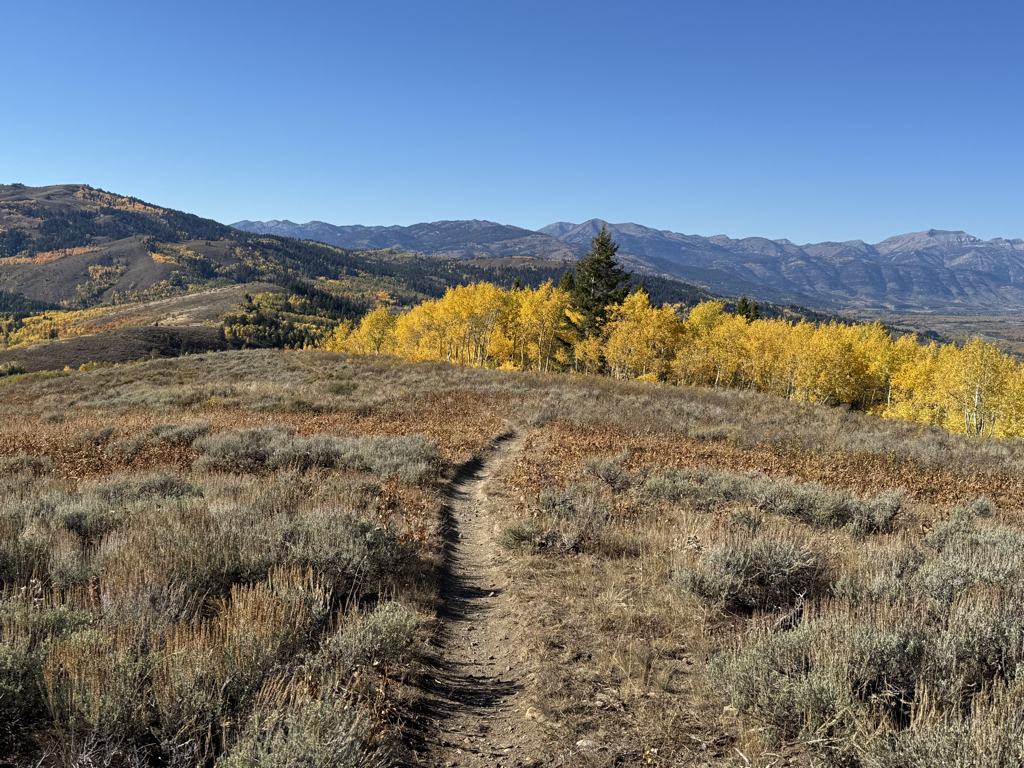
JACKSON, Wyo. – Beautiful fall weather will continue through Saturday with sunny skies and highs in the 70s. A storm system will move into the Western U.S. early next week with a good chance of rain along with cooler temperatures.
Recent Weather
Over the past week, we have enjoyed some outstanding fall weather, but a storm system also brought widespread rain to the area on Sunday and Monday, along with a few thunderstorms.
Rain totals on Sunday and Monday ranged from 0.4 to 1.4 inches across the Greater Teton Region, with the heaviest amounts on the west side of the range. Grand Targhee received 1.4 inches of rain while Victor picked up about an inch.
The town of Jackson received 0.49 inches of rain, while the mid-mountain plot at Jackson Hole Mountain Resort received 0.78 inches of rain.
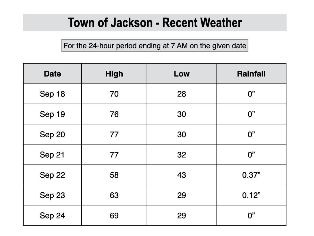
Cooler air accompanied this system with a high of only 58º in Jackson on Sunday. However, snow levels remained fairly high, hovering around 10,000 feet on Sunday night and Monday.
The very top of Jackson Hole Mountain Resort and Grand Targhee were dusted with wet snow from time to time, but it didn’t stick around long. The higher peaks of the Tetons received more substantial snowfall, however.
Temperatures in the town of Jackson over the past week ranged from a high of 77º to a low of 28º. We are now at the time of year when overnight freezes should be expected in the Jackson Hole Valley on nights when skies are clear and winds are light.
Upcoming Weather Pattern
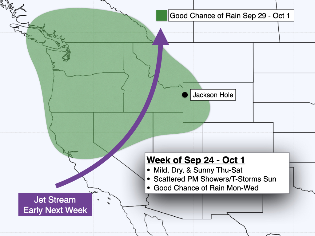
The end of the week will feature beautiful weather with high pressure in place over the Interior West. Highs will reach the 70s in the valley each day under sunny skies with overnight lows near freezing. Fall colors will also be close to peak this weekend.
On Sunday, we will start to see some subtle changes to the weather pattern.
As a trough of low pressure approaches the West Coast, a leading edge disturbance will approach our area from the south, resulting in a chance of scattered showers and thunderstorms.
For now, the best chance of showers looks to be during the afternoon and evening hours on Sunday. Temperatures will remain mild, however, with highs reaching the 70s once again.
The low pressure trough will push into the Western U.S. during the first half of next week, with rain chances increasing across our area during the Monday to Wednesday timeframe. Temperatures will also trend cooler over time.
Despite the arrival of cooler air, for now, snow levels are projected to remain high (10,000 feet or above) at least initially. There is a chance that snow levels could dip below 10,000 feet around the middle of next week, but confidence is low this far out.
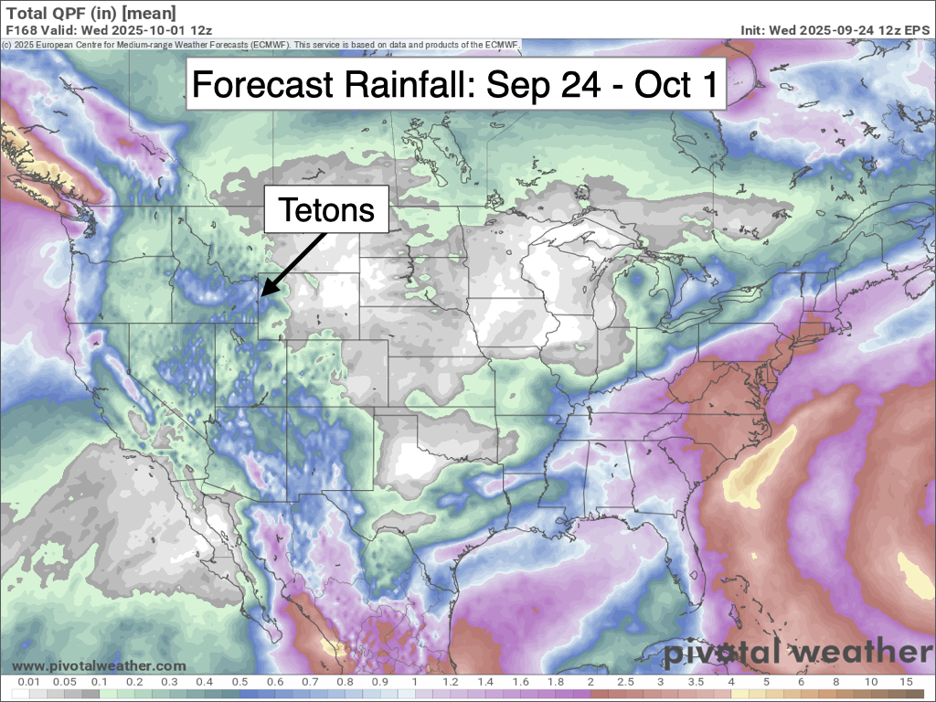
Here is a 7-day precipitation projection from the European Ensemble Model, which represents the average of 50 simulations of this model.
Looking further out, longer-range models are hinting at a possible return to milder and drier weather late next week and into the first weekend of October, but confidence is low.
Alan Smith, Meteorologist









